“The map is not the territory.”
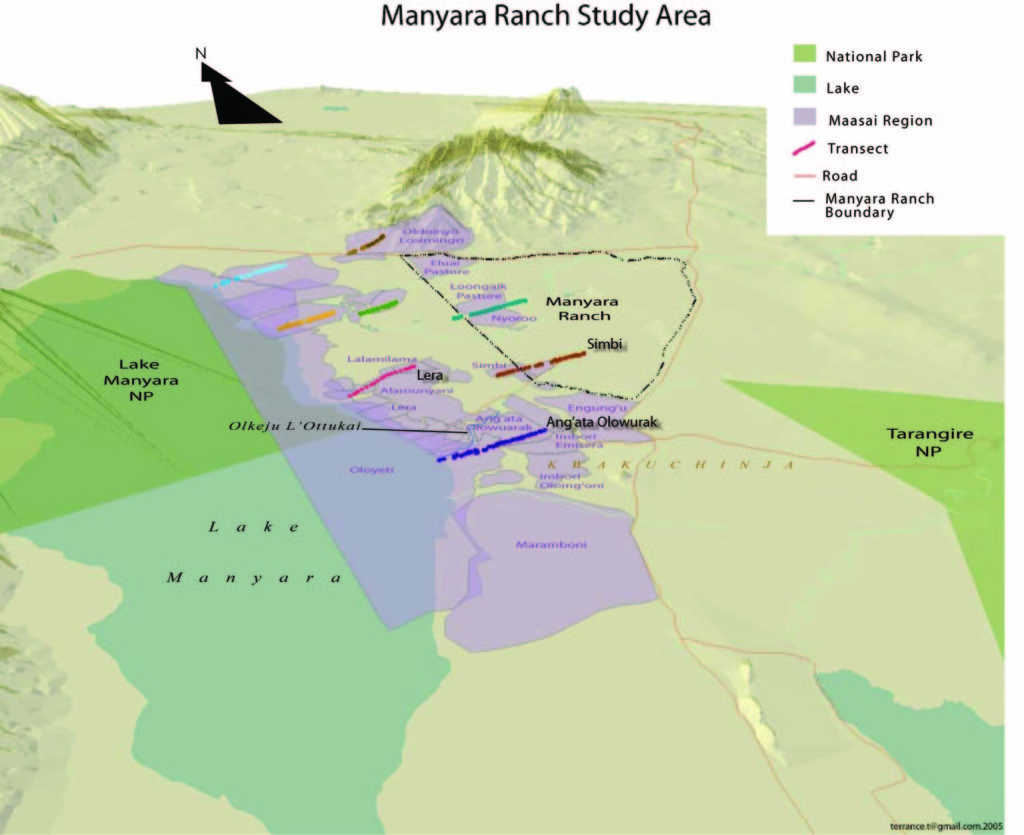
Manyara Ranch wildlife transects with relief feature base layer generated from contour layer. The maps visualize conservation data and display approximate numbers and locations for various species observed from transect lines. Additionally, they delineate previously unmarked regional boundaries for a proposed wildlife corridor to minimize disruption to cattle grazing and movement. The maps also served as a means of confirming data via communication with local tribes with no knowledge of aerial maps. (ArcGIS)
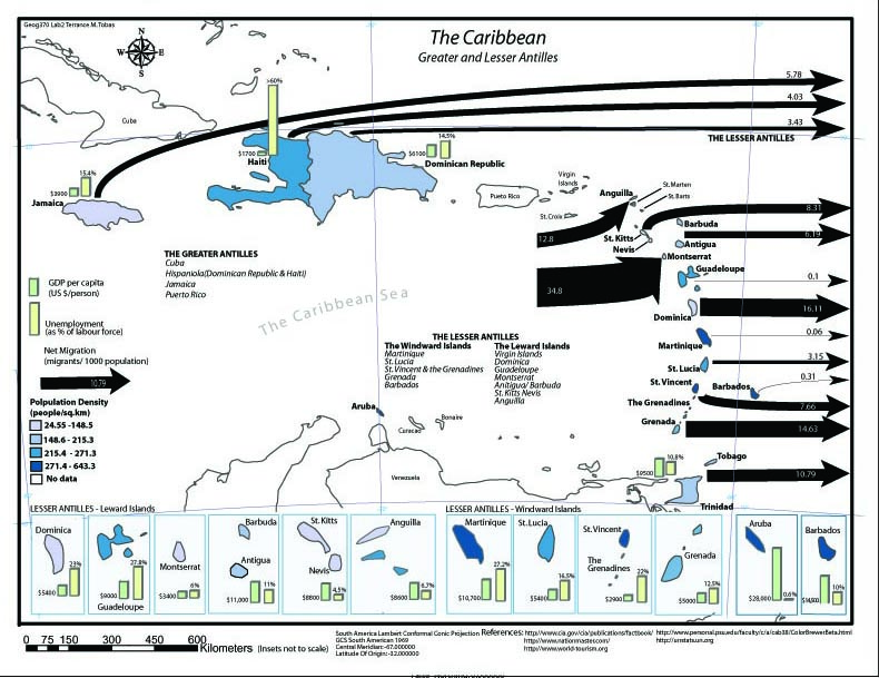
Cribbean Migration Pressures showing GDP, unemployment, net migration, population density. (Adobe Illustrator)
International travel map with custom icons. (Google Maps, Strava, QGIS)